KPL
(KPL) Decades ago we may have heard from parents, elderly, teachers the phrases that demonstrate the richness of Attapeu Province: “Poor Attapeu trades gold jewellery for a hen, poorest Saravan trades an elephant for a torch”. These phrases suggest the abundance of natural resources: silver, gold, precious stones, soil, water, among others in the two provinces.

(KPL) Decades ago we may have heard from parents, elderly, teachers the phrases that demonstrate the richness of Attapeu Province: “Poor Attapeu trades gold jewellery for a hen, poorest Saravan trades an elephant for a torch”. These phrases suggest the abundance of natural resources: silver, gold, precious stones, soil, water, among others in the two provinces.
These resources contribute to not only the socio-economic development in Attapeu Province but also the poverty reduction of the country.
Attapeu has a long history. It is located in the south of Laos. The country’s 7th largest plain, 10,320 sq km, is located in this southern province. Attapeu borders Xekong to the north, Ratanakiri and Stung Treng of Cambodia to the south, Kon Tum of Vietnam to the east and Champassak to the west. The province is partly mountainous, 800 to 1,560 m asl.
Today, we won’t talk about mineral resources but over 20 tourist attractions you deserve to know before planning a trip to Attapeu. These include Tad Cho Waterfall, Vat Luang Rattanaram, Fangdeng Temple, Meuang Kao Voraram Temple, Xekong Bridge, Lao-Vietnamese Heroes Memorial, Blue Lake, Ongsen Sukaram Temple (Sakhe village), King Saysetthathirat Stupa Temple, Man’s Head Waterfall, Tad Phok Waterfall, Tad Od Waterfall, Tad Ya Waterfall, Xepha Waterfall, Kob Xepian Waterfall, Samongphak Waterfall, Soviet Missile Memorial and Xeponglai Waterfall.
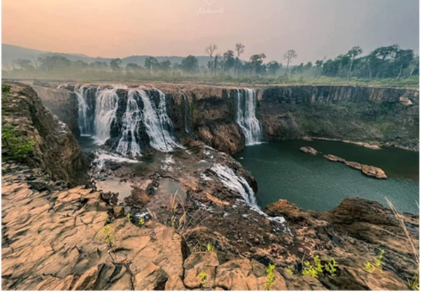
Nevertheless, among the above mentioned tourist attractions, the most well-known, even to neighbouring countries is “Xeponglai Waterfall”. This waterfall is located in Xepian area of Sanamxay district, Attapeu Province. It is 75 km from the administration centre of the district. The waterfall is part of the Xepian River which originates from Phoukhonnon Mountain in the Xepian National Park.
Explored in 1998, Xeponglai Waterfall is 130 m wide, and has two small falls with the left one is 20 m high and the right one is around 35-40 m tall.
The waterfall can be reached all year round by car, motorcycle and bicycle. There are many attractions along the road heading to the waterfall and it is up to you to have a short stop or just straight ahead.
In case you need to have a stop for trekking or watching wildlife you can have so at Mai village which is 55 km from the provincial administration hub.
Xeponglai Waterfall can be reached by driving on either Attapeu Provincial Road or Paksong Road.
KPL